Bandjougoy Drilling Confirms Scale and Potential
Earlier pilot scale test work delivered 62 – 65% Fe product grades
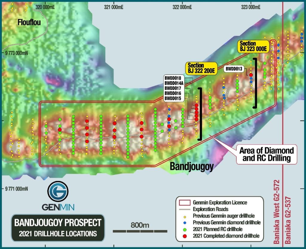
Genmin is pleased to report the results of the first two drill sections from its recently completed diamond drilling program at the Bandjougoy prospect at its 100% owned Baniaka Iron Ore Project located in the Republic of Gabon, Central West Africa.
Drilling intersected oxidised iron mineralisation beneath the Detrital Iron Deposit mineralisation at Bandjougoy. Oxide iron mineralisation comprises both Soft Oxide and Intact Oxide material types. DID and Soft Oxide are the primary targets to support a mining operation at Baniaka.
Highlights
- Diamond drilling Oxide Mineral Resource growth program completed at Bandjougoy prospect.
- Program comprised 25 holes for approximately 3,000m and builds on 12 diamond holes completed in 2018.
- Drill results reported in this announcement represent the first 6 of the 25 diamond holes. Assay results pending for the remaining 19 holes. Drill results continue to confirm a large-scale, flat-lying mineralised system at or near surface.
- Bandjougoy’s strike length of 6.3km is the single largest target for Oxide mineralisation at Baniaka without an Oxide Mineral Resource; it has an in-situ Oxide Exploration Target of 67-124Mt at 35-49% Fe.
- The strike length and width of Bandjougoy show favourable geometry for the potential development of a large-scale open pit mining operation.
- Pilot scale metallurgical test work on bulk Bandjougoy Detrital Iron and Soft Oxide samples returned Lump, Fines and Pellet Feed products between 62 and 65% Fe.
- Bandjougoy is now anticipated to provide the centre of gravity for the Baniaka Preliminary Feasibility Study, which is scheduled for completion at the end of Q1 2022.
To ready today's announcements in full, visit the Investors Centre on our website.
Drillhole location plan for Bandjougoy prospect showing planned 2021, previous Genmin drill collars, and locations of drill sections BJ322200E & BJ323000E
Notes: Background image is Analytic Signal of gridded ground magnetic data
Coordinates are registered to the WGS84 Datum, UTM Zone 33 South projection.